Lot of Vintage Maps of Canada incl Vacationlands and City Map of Victoria

  • $9.60
  • $12.00
Availability: In Stock

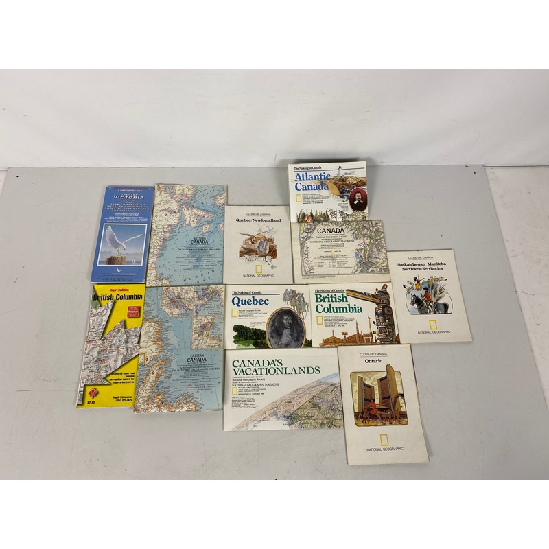
Item Details:Titles Included: Lot of National Geographic Maps of: Ontario (33x22.5), Western Canada (25x19), Eastern Canada (25x19), Canada Vacationlands (34x22.5), Saskatchewan (31x22.5), British Columbia ( 27x20), Quebec (27x20), Canada (31x22.5), Atlant


Categories: ,
Share:
payment

Item Details:

  • Titles Included: Lot of National Geographic Maps of: Ontario (33x22.5), Western Canada (25×19), Eastern Canada (25×19), Canada Vacationlands (34×22.5), Saskatchewan (31×22.5), British Columbia ( 27×20), Quebec (27×20), Canada (31×22.5), Atlantic Canada (27×20), & Quebec/Newfoundland (29×22.5). W/ Mapart: British Columbia, & Davenport Map: Greater Victoria
  • Publisher:National Geographic Society & Mapart Publishing & Davenport Maps LTD
  • Copyright: 1966-1997

Condition:

  • Maps vary from good condition to acceptable
  • Tearing to few maps
  • Soiling to maps; readability unaffected
  • Writing on few maps; readability unaffected
  • Maps are easy to fold
  • Foxing to maps; readability unaffected
  • Coloring has dulled slightly with age

Reviews

There are no reviews yet.

Be the first to review “Lot of Vintage Maps of Canada incl Vacationlands and City Map of Victoria”

Your email address will not be published. Required fields are marked *